Architecture
This chapter describes the architecture of the InfDB project, which integrates geospatial and temporal data.
System Overview
InfDB is a data integration project that combines static 3D city models with dynamic time-series data. It bridges 3DCityDB and TimescaleDB by leveraging raster-based spatial resolution.
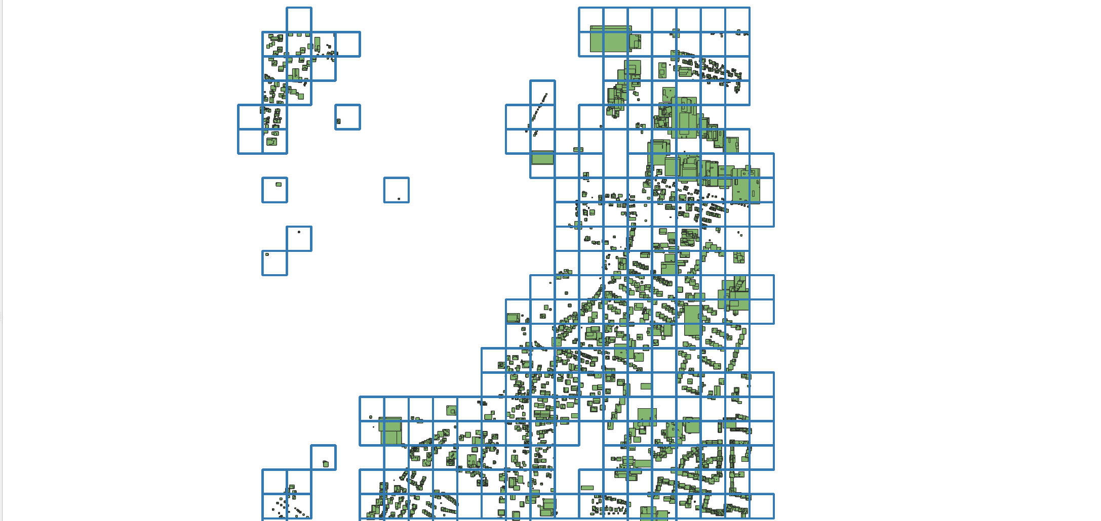
Depending on the given resolution (e.g., 100m, 1000m), InfDB generates same grids under raster table with the same time of IDs provided by https://gdz.bkg.bund.de/index.php/default/open-data/geographische-gitter-fur-deutschland-in-lambert-projektion-geogitter-inspire.html
Each building is assigned to one or more rasters based on a given resolution (e.g., 100m, 1000m). Each raster has a unique ID, allowing weather data to be associated with spatial regions. By resolving a building’s assigned raster(s), the system can efficiently fetch related historical weather data.
For Api usage, you can check API Overview.
Components
3DCityDB A spatial database (PostgreSQL/PostGIS) storing static city model data such as buildings, terrain, and geometry.
TimescaleDB A time-series extension of PostgreSQL used to store and query dynamic data like historical weather measurements.
FastAPI Backend A Python-based web service exposing RESTful endpoints for interacting with both databases.
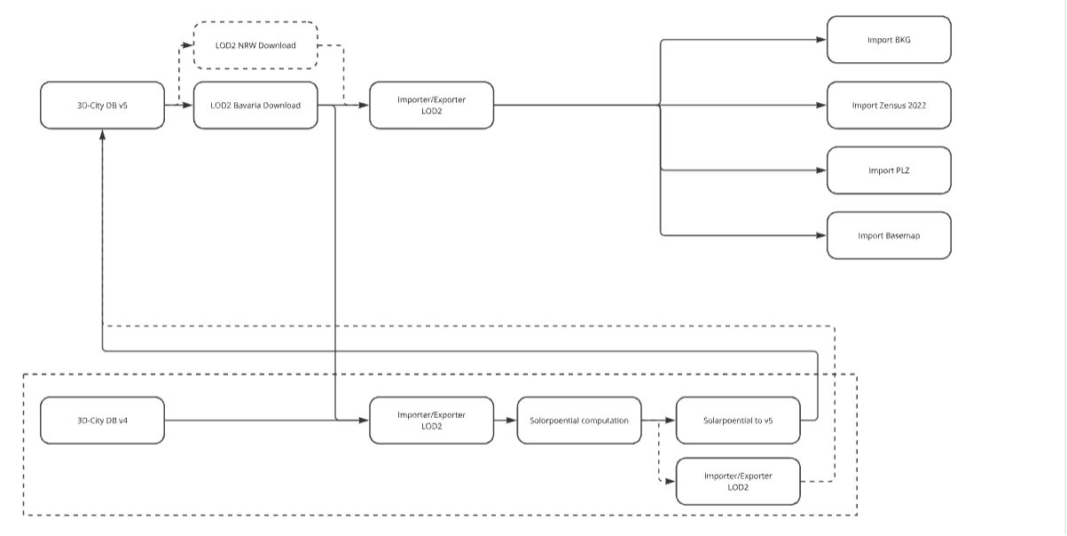
Data Importer A modular system designed to import sepearate data source at any time to 3DCityDB. Each importer is automated using Docker Compose and integrates with 3DCityDB via the CityDBImporter tool.
Database Schema
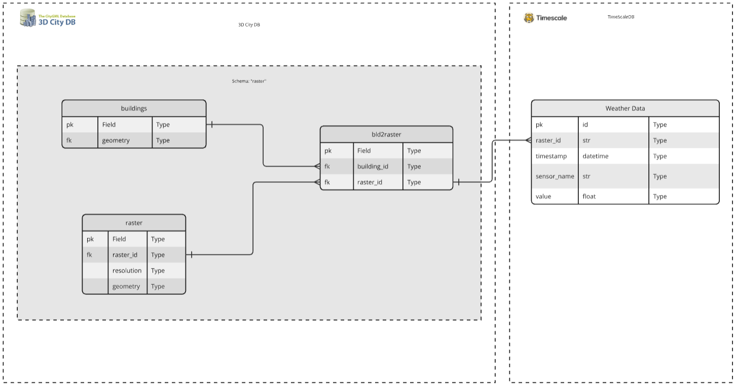
3DCityDB Schema
Based on the CityGML model, it includes two additional application tables created at startup:
`raster`
Contains a unique raster_id, a resolution (100, 1000, 10000, 100000 in meters), and associated geometry.
IDs are generated in the same format as described at: https://gdz.bkg.bund.de/index.php/default/open-data/geographische-gitter-fur-deutschland-in-lambert-projektion-geogitter-inspire.html
`building_2_raster` A many-to-many mapping table between buildings and rasters:
Links each building_id to a raster_id with an associated resolution.
Supports multiple assignments of the same building to different rasters based on resolution.
Allows each raster to contain multiple buildings.
Enforces uniqueness through a composite key on (building_id, raster_id).
TimescaleDB Schema Stores time-stamped sensor readings (e.g., temperature) linked to a raster_id.
Integration Points
CityDB Tool Loads validated GML files into 3DCityDB.
External Weather APIs Connects to the Weather Service for historical weather data fetching.
Visualization Tools Static CityDB data can be visualized via QGIS.